Fish Finders and Electronics for Kentucky Lake Fishing
Fishing Kentucky Lake can feel like searching for a needle in a haystack, especially when you're targeting those elusive bass or schools of crappie in its vast 160,000 acres. The sheer size of this waterbody, coupled with its diverse underwater topography, makes relying solely on guesswork or traditional methods incredibly frustrating. This guide is all about demystifying the world of fish finders and marine electronics, showing you how these tools aren't just fancy gadgets but essential companions for unlocking Kentucky Lake's hidden treasures and transforming your fishing success.
The Essential Role of Fish Finders in Kentucky Lake Fishing
Imagine trying to navigate a dense forest blindfolded, searching for a specific type of tree. That’s a bit like fishing Kentucky Lake without the aid of modern electronics. This sprawling reservoir, formed by the Tennessee River, holds incredible potential, but its size and complexity demand a smarter approach. Fish finders aren't just for the pros anymore; they're becoming a staple for any angler serious about consistently finding fish and understanding the underwater world they inhabit.
Why Traditional Methods Fall Short on Big Water
For generations, anglers relied on their intuition, local knowledge, and tried-and-true methods like reading the water, looking for birds, or understanding seasonal patterns. While these skills are still invaluable, when you're faced with a body of water the size of Kentucky Lake, they can only get you so far. You might spend hours casting into seemingly promising coves or along shorelines, only to come up empty-handed because the fish are holding in deeper, unseen structures.
Think about it: Kentucky Lake has miles of submerged creek channels, ledges, humps, and brush piles – features that are completely invisible from the surface. Without a way to "see" these structures, you're essentially guessing. You might stumble upon a honey hole purely by chance, but consistent success, especially when targeting specific species like bass or crappie, requires more than luck. The frustration of fruitless hours spent on the water is a common complaint, and it often stems from not having the right tools to identify where the fish are holding, or even if they're there at all. This is where the game truly changes.
How Sonar Technology Transforms Your Fishing Experience
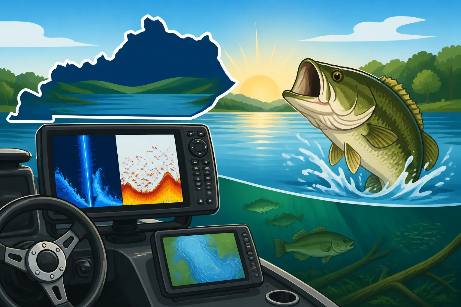
Enter sonar technology, the angler's underwater eyes. A fish finder uses sound waves to detect objects beneath your boat, bouncing those waves off the bottom, fish, and structure, then translating them into an image on a screen. This isn't just about seeing individual fish; it's about understanding the entire underwater ecosystem. You can identify schools of baitfish, pinpoint submerged trees, follow contours, and see exactly where game fish are positioned in relation to these features.
This insight fundamentally changes how you approach a day on the water. Instead of aimlessly cruising, you can strategically search specific depths or structures where you know fish are likely to congregate. You can quickly identify transitions in depth, locate drop-offs, or find hidden brush piles that hold big bass. This not only saves you time but drastically increases your chances of a successful outing. For anglers focused on specific species, knowing where fish are holding becomes paramount. For instance, understanding the Kentucky Fishing Seasons: What to Catch Each Month can be greatly enhanced when you can visually confirm fish presence in seasonal areas.
Understanding Different Types of Fish Finder Technology
The world of fish finders has evolved dramatically, moving beyond simple depth sounders to sophisticated imaging systems. Each type of technology offers a unique perspective, and understanding their differences is key to choosing the right setup for your Kentucky Lake adventures. You don't need every single bell and whistle, but knowing what's available helps you make an informed decision for your fishing style.
Down Imaging and Side Imaging: Seeing Below and Around
These technologies are often considered the bread and butter of modern fish finding. Down Imaging, sometimes called DownScan or ClearVü, provides a picture-like view directly beneath your boat. It uses a very narrow, high-frequency beam to create incredibly detailed images of structure, baitfish, and individual fish. You'll see submerged timber, rock piles, ledges, and even distinct fish arches with remarkable clarity, almost like a photograph. This view is fantastic for dissecting specific cover you're fishing over.
Side Imaging, or SideScan, takes it a step further. Instead of just looking down, it projects beams out to the sides of your boat, covering a much wider swath of water. This allows you to "scan" large areas quickly, revealing structure and fish hiding off to the port and starboard. Imagine idling down a creek channel and seeing brush piles or schools of crappie 50 feet to your left or right, which you would have completely missed with traditional sonar. This panoramic view is incredibly powerful for locating potential hotspots before you even pass over them, saving immense time and allowing you to fish more efficiently. It's especially useful on a vast lake like Kentucky Lake, where covering water efficiently is crucial.
2D Sonar: The Tried and True Classic
Before the advent of hyper-realistic imaging, there was 2D sonar, and it's still a core component of most modern fish finders for good reason. 2D sonar displays a cone-shaped beam that shows you a more traditional, arc-based representation of fish and structure. While not as photo-realistic as Down or Side Imaging, its strength lies in its ability to show target separation and movement. Fish appear as arches, and the shape and size of the arch can give you clues about the fish's size and how it's moving through the cone.
Many experienced anglers still rely heavily on 2D sonar because of its reliability and its ability to penetrate deeper water with less interference, especially in certain conditions. It's excellent for marking fish in the water column and for a general understanding of depth and bottom composition. Think of it as your foundation; the imaging technologies add layers of detail on top of this reliable base. Pairing 2D sonar with imaging allows you to get both a broad overview and detailed close-ups, giving you a comprehensive understanding of the underwater environment.
Advanced Sonar: Live Sonar and Forward-Facing Views
The newest frontier in fish finding is "live" or "forward-facing" sonar, offered by brands like Garmin with LiveScope, Humminbird with Mega Live, and Lowrance with ActiveTarget. This technology is a true game-changer, providing real-time, video-like views of what's happening in front or around your boat. Instead of seeing a historical record of what you've passed over, you're watching fish swim, baits fall, and fish react to your presentation in real-time.
Imagine casting to a submerged brush pile and watching your lure descend right into a school of bass, seeing them approach and strike. This capability allows for unprecedented precision in lure presentation and immediate feedback on fish behavior. While these systems represent a significant investment, their ability to help anglers "hunt" individual fish or schools with precision has made them incredibly popular, especially for tournament anglers on big lakes like Kentucky Lake. It provides a distinct advantage, allowing you to react instantly to fish movements and refine your technique on the fly.
Key Features to Look For in a Kentucky Lake Fish Finder
Choosing a fish finder isn't just about picking a brand; it's about selecting a tool with features that align with your fishing style and the demands of Kentucky Lake. This means considering everything from how clearly you can see the screen to how accurately it can pinpoint your location on a map. Don't let the technical jargon overwhelm you; focus on what truly impacts your ability to find and catch fish.
Screen Size and Resolution: Clarity on the Water
When you're out on Kentucky Lake, battling glare or trying to decipher tiny details on a small screen can be a real headache. This is why screen size and resolution are paramount. A larger screen, say 9 inches or more, provides much more real estate to display multiple sonar views (like 2D, Down, and Side Imaging simultaneously) without making them microscopic. You won't have to constantly toggle between screens, which means less time fiddling and more time fishing.
High resolution (measured in pixels, like 1024×768 or higher) ensures that the images are sharp and clear, making it easier to distinguish between a submerged log and a school of fish. Cheaper units might have lower resolution, making it harder to interpret the subtle nuances of structure or fish arches. On a bright, sunny day, a high-quality, anti-glare screen can make all the difference, preventing eye strain and ensuring you don't miss crucial information. If you plan to spend long hours dissecting contours on Kentucky Lake, investing in a larger, higher-resolution display will pay dividends in reduced frustration and improved understanding.
GPS and Mapping Capabilities: Navigating and Marking Hotspots
Modern fish finders are rarely just fish finders; they're almost always integrated with GPS and mapping. This combination is absolutely critical for navigating a vast body of water like Kentucky Lake. A built-in GPS allows you to see your boat's position on a detailed map, preventing you from getting lost and helping you return to specific areas. It's an essential safety feature, but also a powerful fishing tool.
Mapping capabilities, often including preloaded contour maps of major lakes, provide detailed topographical information of the lake bottom. You can see depth changes, ledges, humps, and old river channels – all prime fish-holding structures. The ability to mark waypoints (specific spots like a brush pile, a productive stump, or a boat ramp) and create routes means you can save your productive spots and return to them with precision. Imagine finding a school of bass on a deep ledge using your Side Imaging, marking it with a waypoint, and then being able to navigate back to that exact spot months later. This feature is indispensable for building a personal database of fishing hotspots on Kentucky Lake and remembering areas that have been productive. For more on navigating larger waters, you might find Boat Ramps and Public Access Points on Kentucky Lake useful for planning your approach.
Transducer Power and Frequency: Deeper Dives and Finer Details
The transducer is the heart of your fish finder, sending and receiving the sonar waves. Its power (measured in watts) and frequency (measured in kilohertz, kHz) directly impact performance. Higher wattage generally means better depth penetration and the ability to get clearer returns in deeper water, which is important when fishing deep channels or humps on Kentucky Lake.
Frequency is a bit more nuanced. Lower frequencies (like 50 kHz or 83 kHz) are great for deeper water penetration and covering a wider cone angle, but they offer less detail. Higher frequencies (like 200 kHz, 455 kHz, 800 kHz, or even Mega Imaging frequencies around 1.2 MHz) provide much finer detail and target separation, which is crucial for distinguishing individual fish from structure or small baitfish schools. However, higher frequencies generally don't penetrate as deep and have narrower cone angles. Many units offer dual-frequency transducers, allowing you to switch between them or use both simultaneously for the best of both worlds. For serious anglers, understanding how these frequencies interact with the water and the fish you're targeting can make a significant difference in interpreting what you see on screen.
Integrating Chartplotters and GPS for Enhanced Navigation
While many fish finders come with integrated GPS and mapping, dedicated chartplotters offer an even more robust navigation experience. For a body of water as expansive and structurally rich as Kentucky Lake, separating your fish finding from your primary navigation can offer numerous advantages, giving you clearer displays and more processing power for each task. It's about building a comprehensive electronics suite that maximizes your efficiency and safety.
Chartplotters: Your Onboard Navigation Partner
A chartplotter is essentially a marine GPS unit that displays nautical charts and maps. While modern fish finders often incorporate these features, a standalone chartplotter, or a high-end combination unit optimized for navigation, can provide a larger, more dedicated display for mapping. This allows you to keep your sonar screens focused on fish and structure, while your chartplotter handles the bigger picture of where you are, where you're going, and what hazards might be present. This separation can be especially useful when navigating unfamiliar waters or during complex maneuvers on Kentucky Lake.
These units typically have more robust processors and memory, allowing for smoother map scrolling, faster satellite acquisition, and the ability to store more waypoints and tracks. For a large lake, having a clear, uncluttered navigation screen is vital for safety, especially when dealing with heavy boat traffic or navigating at dawn and dusk. Many seasoned anglers opt for a multi-screen setup, dedicating one screen purely to navigation and another to various sonar views.
The Power of Preloaded and Custom Mapping
Most quality chartplotters and combo units come with preloaded marine charts and lake maps from reputable sources. These maps often include detailed contour lines, navigation aids, and points of interest for major bodies of water like Kentucky Lake. Brands like Humminbird, with their LakeMaster maps, and Lowrance, with their C-MAP Genesis, offer incredibly detailed bottom contours and shaded relief, giving you a near 3D understanding of the underwater terrain. These preloaded maps are invaluable for identifying ledges, deep creek channels, and submerged humps that attract fish.
Beyond preloaded options, many systems allow for custom mapping. This means you can record your own sonar logs as you drive around the lake, and the unit will create highly detailed, personalized contour maps of the areas you've covered. This "crowdsourced" mapping, or even personal mapping, allows you to discover and highlight subtle bottom features that might not be on standard charts. This level of detail can be a game-changer for finding those obscure, less-pressured fishing spots on Kentucky Lake, giving you a unique advantage.
Waypoints and Routes: Mastering Your Fishing Grounds
The ability to create, save, and manage waypoints and routes is fundamental to effective fishing on a large lake. A waypoint is simply a saved location – it could be a brush pile you found with Side Imaging, a productive stump, a navigation hazard, or your favorite boat ramp. By marking these spots, you can return to them with pinpoint accuracy later, even if the conditions have changed.
Routes allow you to string multiple waypoints together to create a predefined path. This is useful for planning a fishing excursion, navigating a safe course through tricky areas, or repeatedly running a specific trolling pattern. On Kentucky Lake, you might create a route that follows a deep river channel edge, marking every promising turn or piece of cover you encounter. The combination of detailed maps, precise GPS, and robust waypoint/route management means you can systematically explore and "master" your fishing grounds, turning random casting into targeted angling. Being able to mark the Best Bass Fishing Spots on Kentucky Lake and return to them is key to consistent success.
Additional Electronics to Optimize Your Kentucky Lake Setup
While fish finders and chartplotters form the core of your marine electronics, several other gadgets can significantly enhance your fishing experience and overall safety on Kentucky Lake. These aren't just luxuries; they're tools that contribute to efficiency, communication, and peace of mind, especially on a large, active waterway.
Trolling Motors with Integrated Sonar
Modern trolling motors have become far more than just propulsion units. Many high-end models now come with integrated sonar transducers, often compatible with the leading fish finder brands. This means the transducer is built directly into the lower unit of the trolling motor, providing a clean, protected installation and eliminating the need to mount a separate transducer on the bow. More importantly, it provides incredibly clear, interference-free readings, especially from the front of the boat where many anglers do their precision casting.
Some advanced trolling motors even integrate with your chartplotter and GPS, offering features like "spot-lock" (which uses GPS to automatically hold your boat in a precise position, even in wind or current) and "follow-the-contour" modes. Imagine finding a productive ledge on Kentucky Lake with your fish finder, dropping your trolling motor, hitting spot-lock, and being able to cast without ever touching your foot pedal. This level of integration streamlines your fishing, allowing you to focus purely on presentation. For a closer look, check out Best Trolling Motors for Kentucky Lake Bass Fishing and How to Choose a Trolling Motor for Big Water Fishing.
VHF Radios for Safety and Communication
Kentucky Lake is a large body of water, and while cell phones are common, they aren't always reliable, especially in more remote coves or during emergencies. A VHF (Very High Frequency) marine radio is an essential safety device for any boater, allowing for reliable communication with other vessels, marinas, and emergency services (like the Coast Guard, although that might be less common on an inland lake, local authorities would still monitor).
In an emergency, such as a breakdown, medical issue, or severe weather, a VHF radio can be a lifeline. Many units also have a Digital Selective Calling (DSC) feature, which, when connected to your GPS, can send an automated distress signal with your exact location to authorities at the press of a button. For general communication, it's also useful for coordinating with fishing buddies or getting weather updates. Having a reliable communication method, independent of cellular networks, is just smart boating, adding a crucial layer of safety to your Kentucky Lake adventures. Essential Safety Gear for Every Boat in Kentucky further elaborates on important safety measures.
Onboard Charging Systems and Power Management
With multiple electronics running – fish finders, chartplotters, trolling motors, livewells, and maybe even a radio – managing your boat's power system becomes critical. You don't want your batteries to die in the middle of a hot bite or, worse, leave you stranded. A dedicated onboard charging system is a must-have for serious anglers. These chargers are designed to maintain multiple batteries simultaneously, ensuring they are fully topped off and ready for the next trip.
Beyond charging, smart power management involves using high-quality marine batteries (deep cycle for trolling motors, cranking for your main engine), properly wiring your accessories, and understanding your power draw. Some electronics offer low-power modes, and many anglers carry portable jump starters for emergencies. Brands like Minn Kota and ProMariner offer excellent charging solutions. Investing in a robust electrical system ensures all your valuable electronics have the juice they need to perform throughout your long days on Kentucky Lake.
Setting Up and Calibrating Your Fish Finder for Kentucky Lake
Getting the most out of your fish finder isn't just about buying a good unit; it's about proper installation and understanding how to fine-tune its settings for the specific conditions you encounter. A poorly installed transducer or incorrect settings can turn a top-tier fish finder into a frustrating guessing game. Taking the time to set up and calibrate your system properly will unlock its full potential.
Proper Transducer Placement and Installation
The transducer is your fish finder's "eye," and its placement is critical. For most boats, it needs to be mounted on the transom or through-hull, in a location that provides a clear shot at the water without interference from turbulence, the propeller, or other obstructions. Air bubbles passing over the transducer face will disrupt the sonar signal, leading to fuzzy screens or lost readings, especially at speed.
A common mistake is mounting it too high or too low. Too high, and it might lose contact with the water at speed; too low, and it could be damaged by hitting submerged objects or create excessive spray. Taking the time to properly mount the transducer, ensuring it's level and in "clean water," is arguably the most important step in the entire setup process. If you have a trolling motor with an integrated transducer, much of this concern is alleviated for bow-mounted applications, but the transom transducer for your main unit still needs careful attention. Many anglers seek professional installation or meticulously follow manufacturer instructions to ensure optimal performance.
Fine-Tuning Settings for Optimal Performance
Once installed, your fish finder needs to be calibrated. While most units have excellent auto settings, manually adjusting certain parameters can significantly improve your view, especially on a diverse lake like Kentucky Lake. Key settings to adjust include:
- Sensitivity/Gain: This controls how much detail the sonar unit picks up. Too low, and you'll miss faint returns (like baitfish or fish tightly to the bottom); too high, and you'll get excessive clutter and noise. Adjust it to the highest level without introducing too much interference.
- Colorline/Chirp Threshold: This setting allows you to differentiate between stronger and weaker returns, often by changing colors. Stronger returns (like hard bottom or large fish) will appear in more intense colors, while weaker returns (like soft bottom or smaller bait) will be in lighter colors. This helps interpret bottom composition and target size.
- Noise Rejection/Surface Clarity: These filters help eliminate clutter from surface turbulence or electrical interference. Experiment with these settings to get the cleanest possible image without filtering out actual fish.
- Depth Range: Setting the depth range appropriately for the water you're fishing ensures the screen is efficiently used. If you're in 20 feet of water, don't set the range to 100 feet; this just compresses the valuable information.
Experimentation is key here. Spend time on the water, adjusting settings in different depths and conditions. What works perfectly in a shallow cove might need tweaking in a deep river channel. Every angler's "optimal" settings can be slightly different, and understanding what each parameter does empowers you to get the clearest picture.
Learning to Read Your Fish Finder Displays
This is where the magic happens, but it also takes practice. A fish finder doesn't show you perfect pictures of fish with labels; it shows you interpretations of sonar returns. Learning to decipher these images is an acquired skill. For 2D sonar, you'll learn to distinguish fish arches from bait balls, and hard bottoms from soft bottoms. On Down and Side Imaging, you'll practice identifying brush piles, rock formations, trees, and how fish relate to them.
Many modern units can display multiple sonar views simultaneously on a split screen. Learning to interpret all these views in conjunction is powerful. For example, your 2D sonar might show a dense school of baitfish, while your Down Imaging clarifies it's a tight ball of shad, and your Side Imaging shows a few larger arches (bass!) lurking just outside the ball. Resources like online forums, videos, and even manufacturer guides (often found on Amazon or manufacturer websites) can greatly assist in this learning process. The more time you spend analyzing what you see on the screen in relation to what you actually catch, the faster you'll become proficient at reading your fish finder. For more dedicated learning, seek out guides on How to Read a Fish Finder for Bass Fishing.
Popular Fish Finder Brands for Kentucky Lake Anglers
When it comes to marine electronics, a few brands consistently stand out for their innovation, reliability, and performance. While personal preference plays a huge role, understanding the general strengths of each can help you narrow down your choices for Kentucky Lake. Each brand brings its own philosophy to the table, and knowing what they excel at can guide your decision.
Garmin: Innovation and User-Friendly Interfaces
Garmin has made a massive splash in the fishing electronics market, especially with their groundbreaking LiveScope technology. Known for its incredibly intuitive and user-friendly interfaces, Garmin units are often praised for being easy to set up and operate, even for beginners. Their touch-screen models are responsive and mimic the feel of a smartphone, which many anglers appreciate.
Beyond LiveScope, Garmin's traditional sonar (often called ClearVü for Down Imaging and SideVü for Side Imaging) offers excellent clarity. Their mapping, often with built-in Navionics charts or Garmin's proprietary Quickdraw Contours (allowing users to create custom HD maps in real-time), is also top-tier for detailed navigation on lakes like Kentucky Lake. For anglers seeking cutting-edge technology combined with ease of use, Garmin is often a prime choice. You'll find a wide selection of Garmin devices at retailers like Bass Pro Shops or online through Amazon.
Humminbird: Imaging Specialists
Humminbird has long been a leader in sonar technology, particularly renowned for its crisp, detailed imaging. Their MEGA Imaging technology (MEGA Down Imaging and MEGA Side Imaging) is often considered the benchmark for clarity and resolution, allowing anglers to see incredible detail of submerged structure and fish, even in shallower depths. This hyper-realistic view is a huge advantage for dissecting brush piles or finding fish tucked into cover on Kentucky Lake.
Humminbird's LakeMaster mapping is another standout feature, providing highly detailed, customizable contour maps for thousands of lakes, including Kentucky Lake. Their "Follow the Contour" feature, when paired with a compatible Minn Kota trolling motor, allows your boat to automatically follow a specific depth contour, which is fantastic for targeting fish on ledges. Anglers who prioritize the absolute best in imaging quality and detailed contour mapping often gravitate towards Humminbird.
Lowrance: Performance and Advanced Features
Lowrance has a long and storied history in marine electronics, often credited with inventing the first recreational fish finder. They continue to be a dominant force, known for their powerful sonar performance and advanced features. Their ActiveTarget live sonar offers real-time views similar to Garmin's LiveScope, providing a competitive edge for those who want to see fish react to their lures.
Lowrance's traditional sonar (often called StructureScan for Down/Side Imaging) provides excellent detail, and their HD displays are known for their vibrant colors and clarity. Their C-MAP Genesis mapping offers highly detailed charts and the ability to create custom maps. Many tournament anglers rely on Lowrance for its robust performance, extensive features, and continuous innovation. They also offer a range of products suitable for various budgets, making them accessible to many anglers who frequent Kentucky Lake.
Maximizing Your Investment: Tips and Best Practices
Buying a fish finder and marine electronics is a significant investment, and like any tool, its value is only realized when used effectively. Merely having the technology isn't enough; you need to understand how to leverage it, care for it, and continuously learn to interpret the information it provides. These best practices will ensure you get the most out of your Kentucky Lake electronics setup.
Practice Makes Perfect: Interpreting Your Screen
The biggest hurdle for many new fish finder owners isn't operating the buttons; it's learning to interpret what's on the screen. Sonar isn't like a video game; it takes practice to distinguish a tight school of baitfish from a brush pile, or a bass from a submerged log. The best way to learn is to spend time on the water, experimenting and actively looking at your screen.
Start by idling over known structures – a submerged bridge, a marked brush pile, or a distinct rock pile. Observe how these features appear on your 2D, Down Imaging, and Side Imaging screens. If you catch a fish, immediately look at your screen to see what it looked like just before the bite. Over time, your brain will start to "see" patterns and shapes, making interpretation almost second nature. Don't be afraid to read your manual, watch instructional videos, or even join online fishing communities where experienced anglers share tips on screen interpretation. The more you use it, the more effective you'll become at finding Best Crappie Spots on Kentucky Lake or those trophy bass.
Software Updates and Maintenance
Just like your smartphone or computer, your marine electronics run on software, and manufacturers frequently release updates. These updates often include performance improvements, bug fixes, new features, or updated mapping data. Neglecting software updates can mean you're missing out on enhanced functionality or even struggling with known issues that have already been resolved. Make it a habit to check your manufacturer's website periodically for the latest software versions. Most updates can be downloaded to an SD card and then installed directly on your unit.
Beyond software, physical maintenance is important. Keep your screen clean with a soft cloth and non-abrasive cleaner. Ensure all connections are tight and free from corrosion, especially in a freshwater environment like Kentucky Lake where moisture and humidity can still cause issues. Periodically inspect your transducer for any damage or marine growth that could impede its performance. Proper care extends the life of your expensive equipment and ensures it performs optimally whenever you hit the water.
Protecting Your Electronics from the Elements
Marine electronics are designed to be rugged, but they're not indestructible. Protecting your investment from the harsh elements is crucial. When not in use, always cover your units with the protective covers that usually come with them. This shields the screen from UV damage, scratches, and dust. If your boat is stored outdoors, consider removing sensitive electronics (if easily detachable) and storing them in a climate-controlled environment, especially during extreme temperatures.
When on the water, be mindful of direct sunlight, which can cause overheating on some units, and heavy rain. While most modern units are waterproof to some degree, a sustained downpour can still challenge their seals. Avoid spraying high-pressure water directly onto your units when cleaning your boat. Taking these simple precautions will significantly prolong the life and reliability of your fish finders and chartplotters, ensuring they're ready to help you find fish on Kentucky Lake for many seasons to come.
Here's a quick comparison of key fish finder features:
| Feature | 2D Sonar | Down Imaging / DownScan | Side Imaging / SideScan | Live Sonar (e.g., LiveScope) |
|---|---|---|---|---|
| View Type | Traditional, arc-based | Picture-like view directly below boat | Picture-like view to the sides of boat | Real-time, video-like view around boat |
| Best For | Target separation, general depth, water column fish | Detailed structure directly below | Quickly scanning wide areas for structure/fish | Watching fish react, precise lure presentation |
| Depth Penetration | Excellent (especially lower frequencies) | Good (high frequency, less deep) | Good (high frequency, less deep) | Good (can see out to ~100ft depending on unit) |
| Image Clarity | Moderate (arches) | High (photo-like) | High (photo-like, wide area) | Excellent (video-like, real-time) |
| Coverage Area | Cone directly below | Narrow beam directly below | Wide beams to port and starboard | Adjustable cone, forward, down or perspective |
| Typical Frequency | 50/83/200 kHz | 455/800 kHz, 1.2 MHz (MEGA) | 455/800 kHz, 1.2 MHz (MEGA) | Varies by brand, high frequency |
Disclaimer
This article is for general informational purposes only and does not constitute professional advice. Laws, prices and regulations vary by location and change over time. Consult a qualified professional for guidance on your specific situation.