Best GPS Units for Boating on Big Lakes
There’s nothing quite like the excitement of hitting a big Kentucky lake, whether it’s the vast expanse of Kentucky Lake, the sprawling waters of Lake Barkley, or the deep canyons of Lake Cumberland. But let's be real, these aren't your grandpa's farm ponds. Getting lost or struggling to return to that prime fishing spot can quickly turn a dream day into a frustrating search. This guide will walk you through everything you need to know about choosing and using the best GPS units to navigate and conquer Kentucky's magnificent, massive waterways with confidence.
Why a Dedicated GPS Unit is Essential for Big Kentucky Lakes
When you're out on a sprawling body of water, especially one as large and intricate as our Kentucky lakes, relying solely on visual landmarks can be a recipe for disaster or at least, a lot of wasted time. A dedicated GPS unit becomes your co-pilot, your memory keeper, and your safety net, all rolled into one indispensable piece of equipment. It’s not just about getting from point A to point B; it's about optimizing your entire fishing experience and ensuring you get home safely.
Navigating Vast, Featureless Waters
Imagine a cloudy day on Kentucky Lake, where the shoreline seems to stretch endlessly, and every cove or bend can start to look eerily similar. Or perhaps you're out on Lake Cumberland, and the deep, towering bluffs create a sense of scale that can quickly disorient even seasoned boaters. On these massive lakes, visual cues that work fine on smaller waters simply aren't enough. The sheer size and often repetitive nature of the shorelines can make it incredibly difficult to maintain a sense of direction or pinpoint your exact location without a reliable digital assistant.
A GPS unit gives you an objective, real-time perspective. It shows you exactly where you are on a detailed map, often with contours, navigation markers, and your boat's icon moving across it. This dramatically reduces the stress of uncertainty, allowing you to focus on fishing rather than constantly second-guessing your direction. For anyone venturing far from familiar ramps, especially on a busy weekend or in less-than-ideal weather, this peace of mind is invaluable. It’s the difference between feeling confident about finding your way back to the Kentucky Boat Ramp Guide for Major Lakes and feeling completely adrift.
Pinpointing Key Fishing Structure and Hotspots
Ask any successful angler, and they'll tell you that finding and consistently returning to productive fishing structure is the cornerstone of a great day on the water. Whether it's a submerged brush pile on Herrington Lake that holds crappie, a deep rock ledge on Lake Barkley where sauger school, or a main lake point on Kentucky Lake: The State's Top Bass Fishing Destination that always produces big bass, remembering its exact location is critical. That's where a GPS unit truly shines for anglers.
With a good GPS, you can mark waypoints with pinpoint accuracy. Found a brush pile with your sonar? Mark it. Caught a lunker off a specific stump? Mark it. Discovered a fantastic trolling run along a creek channel? Save the trail. These digital breadcrumbs allow you to return to those exact coordinates time and time again, even years later, as long as you've saved them. This eliminates guesswork and maximizes your time fishing, rather than searching for past success. Many anglers even use their GPS to meticulously map out their fishing spots, creating a personal library of productive locations.
Enhanced Situational Awareness and Safety
Beyond just finding your fishing spots, a GPS unit significantly boosts your overall situational awareness and safety on big water. These units continuously display your boat's speed, direction, and position. This information is critical for understanding current conditions, calculating travel times, and making informed decisions about where you're headed. Knowing your exact location helps you stay within designated channels, avoid shallow hazards, or steer clear of restricted areas.
In an emergency, such as mechanical failure or a sudden storm, a GPS unit can be a lifesaver. You can quickly get your precise coordinates to share with emergency services, significantly reducing response times. Many units also allow you to set alarms for drift, anchor drag, or even off-course deviations, adding another layer of security. It's a key component of your Essential Safety Gear for Every Boat in Kentucky checklist, alongside your life jackets and first aid kit. Don't underestimate the comfort of knowing exactly where you are and how to communicate that to others when seconds count.
Key Features to Look for in a Big Lake GPS Unit
Choosing the right GPS unit can feel a bit overwhelming with all the options out there, but by focusing on a few core features, you can narrow down the choices and find something perfect for your Kentucky big lake adventures. Think about what truly matters when you're navigating vast water and trying to find elusive fish. It's not just about the most expensive unit; it's about the features that bring value to your specific fishing and boating style.
Detailed Mapping and Chartography
This is arguably the most critical feature for any GPS unit destined for big lakes. Basic navigation is one thing, but detailed, high-definition mapping turns your unit into an invaluable tool. Look for units that come pre-loaded with comprehensive lake maps, or those that have the option to purchase high-quality chartography cards. Brands often offer proprietary map packs, like LakeVü g3 from Garmin or C-MAP from Lowrance, which provide incredible detail.
These advanced maps go far beyond showing just shorelines and major channels. They display precise depth contours, often in one-foot increments, allowing you to visualize underwater topography like ledges, humps, creek channels, and submerged islands. They can also show navigation aids, marinas, boat ramps, and even areas of submerged timber or rock piles. This level of detail is crucial for both safe navigation and effective fishing. Knowing the exact depth changes around a point on Lake Cumberland: Kentucky's Best All-Around Fishing Lake can be the difference between catching trophy walleye or striking out. Always check which map regions are included or available for purchase when considering a unit; you want to ensure it covers the specific Kentucky lakes you plan to fish.
Screen Size and Readability
When you're out on the water, battling sun glare and boat chop, a small, dim screen just won't cut it. The screen size and its overall readability are incredibly important. GPS units typically range from compact 5-inch displays all the way up to massive 16-inch or larger screens. While a bigger screen often means a higher price tag, it also means less squinting and more information visible at a glance. For big lake fishing where you might be scanning sonar and charts simultaneously, a larger screen with split-screen capabilities is a huge advantage.
Consider the screen resolution – a higher pixel count means sharper images and more discernible detail on your maps. Brightness and anti-glare coatings are also critical. Many modern units feature optically bonded displays that reduce glare and improve visibility in direct sunlight, which is common on bright Kentucky afternoons. Think about where you'll mount the unit and how far away you'll be viewing it. A unit that looks great in the store might be a nightmare to read on the water if it's too small or positioned awkwardly.
GPS Accuracy and Refresh Rate
What good is a map if your boat icon isn't precisely where it should be? GPS accuracy and the speed at which the unit refreshes your position are fundamental. Look for units with high-sensitivity GPS receivers, often boasting 10Hz (10 updates per second) or even faster refresh rates. This rapid update ensures that your boat's position on the map is as close to real-time as possible, preventing that annoying "lag" where your boat appears to jump around.
Many units also incorporate WAAS (Wide Area Augmentation System) or other differential correction systems, which significantly improve positional accuracy down to a few feet. For anglers trying to stay directly on top of a specific brush pile or troll a very narrow contour line, this precision is non-negotiable. If your GPS isn't accurate, you could be fishing 20 feet off your target without even realizing it. This level of precision is also vital for navigating tight channels or approaching docks safely, giving you confidence in your exact location.
User Interface and Ease of Use
No matter how many fancy features a GPS unit has, if it's a headache to operate, you won't use it effectively. The user interface (UI) and overall ease of use are paramount, especially when you need to make quick adjustments or find information while your boat is moving. Some units are primarily button-operated, which can be great for gloved hands or in rough water where a touchscreen might be difficult to control. Others are full-touchscreen, offering a tablet-like experience that can be very intuitive for zooming and panning maps.
Many modern units offer a hybrid approach, combining a touchscreen with a few critical buttons. Whichever style you prefer, look for a logical menu structure, easily identifiable icons, and quick access to frequently used functions like marking waypoints or adjusting map views. Reading reviews, checking out units at stores like Bass Pro Shops, or watching online demo videos can give you a good idea of a unit's UI before you commit. You want a unit that feels natural to operate, allowing you to spend more time fishing and less time fumbling through menus.
Types of GPS Units Suitable for Kentucky's Big Lakes
The world of marine GPS units is vast, with options ranging from simple handheld devices to complex, networked systems. For boating and fishing on Kentucky's big lakes, there are generally three main categories of GPS units that anglers consider, each with its own set of advantages and ideal uses. Understanding these types will help you determine which one best fits your needs and budget.
Chartplotter/Fish Finder Combos
For the vast majority of anglers on Kentucky's big lakes, a chartplotter/fish finder combo unit is the go-to choice, and for good reason. These devices integrate a full-featured GPS chartplotter with advanced sonar capabilities into a single, cohesive unit. This means you get detailed mapping and navigation alongside the ability to see fish, structure, and bottom contours beneath and around your boat. Companies like Garmin, Lowrance, and Humminbird offer a wide range of these units, from budget-friendly models to high-end professional setups.
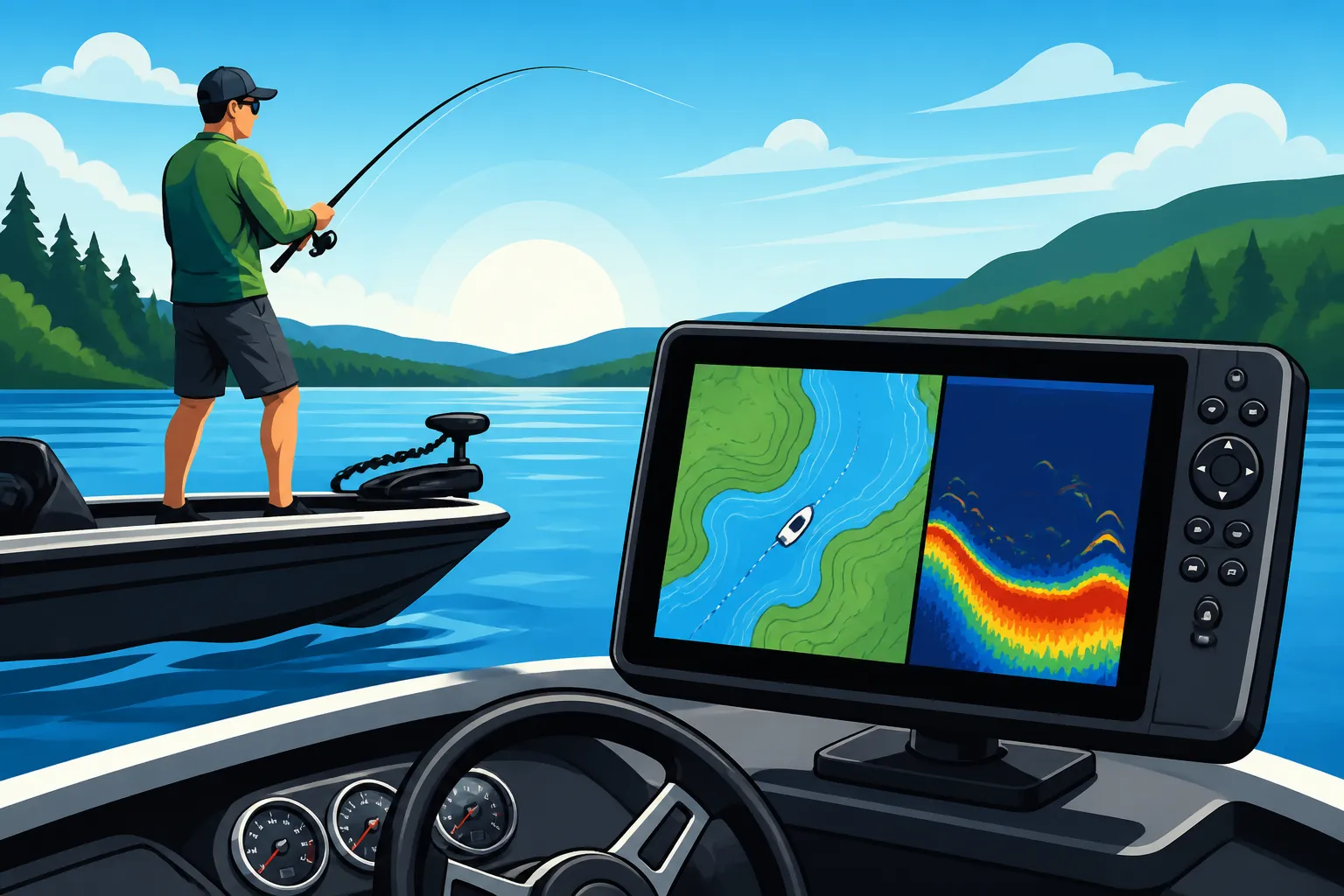
The beauty of a combo unit is the efficiency it offers. You can run split-screen views showing your map on one side and your sonar on the other, allowing you to navigate to a spot and simultaneously scan for fish and structure. This integration also simplifies wiring and mounting, as you only need one display unit. Modern combo units often include 2D sonar, DownScan (for photo-like images directly below the boat), and SideScan (for scanning out to the sides), providing an incredibly comprehensive view of the underwater world. This is exactly the kind of setup that optimizes your time on Lake Barkley Fishing Guide for Kentucky Anglers or any other major fishing destination.
Dedicated Handheld GPS Units
While not as common for primary boat navigation on larger vessels, dedicated handheld GPS units still have a valuable place, particularly for smaller boats, kayaks, or as a reliable backup. These units are compact, typically run on AA batteries for extended life, and are designed to be extremely durable and waterproof. They primarily focus on displaying maps, tracking your position, and allowing you to mark waypoints and routes.
For kayak anglers exploring the smaller coves of Best Fishing Kayaks for Kentucky Lakes and Rivers or even a bank angler wanting to mark a productive spot for future reference, a handheld unit can be incredibly useful. They're also an excellent safety device to keep in your ditch bag as a backup if your main boat electronics fail. The downsides are generally smaller screens, which can be harder to read, and less detailed mapping compared to dedicated chartplotters. They also lack sonar capabilities. However, for sheer portability and reliability in a pinch, they're hard to beat. You can often find a good selection of these on Amazon, with plenty of user reviews to guide your choice.
Marine Multifunction Displays (MFDs)
At the pinnacle of marine electronics are Marine Multifunction Displays, or MFDs. These are essentially large, powerful, networked computers designed for larger bass boats, cruisers, or offshore vessels. MFDs offer expansive screen sizes, incredible processing power, and the ability to integrate with almost every other electronic system on your boat – from radar and autopilot to engine data, stereo systems, and multiple sonar transducers.
While MFDs often come with a higher price tag and require more complex installation, they provide the ultimate in control and information at your fingertips. They are ideal for serious tournament anglers or anyone who spends extended periods on the water and demands the absolute best in integrated technology. Many feature sophisticated user interfaces that are highly customizable, allowing you to configure multiple screens and overlays to your exact preferences. If you're outfitting a high-performance bass boat for competing on Best Boats for Kentucky Lake and Lake Barkley Fishing, an MFD might be exactly what you're looking for.
Installation and Powering Your GPS Unit
Getting your new GPS unit set up correctly is almost as important as choosing the right one. A poorly installed unit can lead to unreliable performance, power issues, or even damage. Proper installation ensures your unit is secure, visible, and receiving clean power, allowing it to perform at its best when you're out on the water, whether you’re fishing or just navigating to your favorite picnic spot.
Mounting Options for Boats
Where you mount your GPS unit on your boat is critical for both usability and safety. The primary goal is to place it somewhere it's easily visible from your driving position but also protected from excessive spray and physical damage. There are a few common mounting styles:
- Gimbal Bracket Mounts: This is the most common and often comes standard with smaller to mid-sized units. It allows the unit to swivel and tilt, so you can adjust the viewing angle to reduce glare or position it perfectly for standing or sitting. They are relatively easy to install, usually requiring drilling a few holes into a flat surface on your console.
- Flush Mounts: For a cleaner, more integrated look, many larger units can be flush-mounted directly into your boat's console. This involves cutting a precise opening and then securing the unit from behind. It offers a very sleek appearance and minimizes protrusions, but it’s a more involved installation process and less flexible for angle adjustments.
- RAM Mounts: These are highly versatile ball-and-socket mounting systems that offer a wide range of adjustability. They're popular for smaller boats, kayaks, or for adding secondary displays, as they allow you to position the unit almost anywhere, even overhead or off to the side. They are known for their strong grip and vibration dampening.
Regardless of the mount type, ensure it's securely fastened to a sturdy part of your boat that can handle the unit's weight and the vibrations of moving across choppy water. You don't want your expensive electronics bouncing around or, worse, falling off when you hit a wave.
Wiring and Power Considerations
Proper wiring is paramount for the reliable operation of any marine electronics, especially a GPS unit. The general rule is to connect your GPS unit directly to your boat's starting battery (or a dedicated electronics battery) with its own dedicated power wires, rather than tapping into existing accessory circuits. This minimizes voltage drops and electrical interference that can compromise performance.
Always use marine-grade wire of the correct gauge for the length of the run and the unit's power draw. Install an inline fuse or circuit breaker close to the battery to protect the unit from power surges. Ensure all connections are watertight and corrosion-resistant using heat-shrink connectors or marine-grade crimps. Poor electrical connections are a common cause of intermittent power, flickering screens, or inaccurate readings. If you're unsure, it's always best to consult with an expert at a marine dealer or Bass Pro Shops for installation advice. Remember, a clean, consistent power supply is vital for optimal GPS performance.
Transducer Placement (for Combo Units)
If you've opted for a chartplotter/fish finder combo, the transducer is the "eye" of your unit, and its placement is critical for clear sonar readings. The transducer needs to be mounted in a location that provides an unobstructed view of the water beneath your boat, free from turbulence or air bubbles created by the hull or prop.
Common transducer mounting options include:
- Transom Mount: The most common and easiest to install. It bolts to the boat's transom, allowing for easy adjustment.
- Through-Hull Mount: Requires drilling a hole through the hull. Provides excellent, uninterrupted readings at all speeds, but is a more permanent and involved installation.
- In-Hull (Shoot-Through) Mount: The transducer is epoxied inside the hull, shooting through the fiberglass. It's great for avoiding external damage, but works best on solid fiberglass hulls and may result in some signal loss.
The goal is to find a "clean water" spot. Test your transducer placement by running your boat at various speeds and observing the sonar screen. If you see excessive noise or loss of bottom readings at speed, you may need to adjust the angle or relocate the transducer. Without a properly functioning transducer, even the best combo unit will only give you half the picture.
Tips for Maximizing Your GPS Unit's Potential
Having a powerful GPS unit on your boat is like owning a high-performance sports car – it's only as good as how you use it. To truly leverage its capabilities and make your time on Kentucky's big lakes more productive and safer, you need to understand how to interact with it effectively. Don't just turn it on and go; delve into its functions to unlock its full potential.
Creating and Managing Waypoints and Trails
This is where the real magic happens for anglers. Every time you find something interesting – a brush pile, a productive ledge, a deep hole, or even just a safe passage through a shallow area – mark it! Your GPS unit allows you to create waypoints, which are essentially digital pins on your map with precise coordinates. Give them descriptive names (e.g., "Crappie Brush Pile N", "Bass Point 20ft", "Danger Rock"). Over time, you'll build an invaluable library of fishing spots and navigational markers.
Equally important are trails (also called tracks). These are electronic breadcrumbs your unit leaves behind, recording your exact path. Use them to retrace a successful trolling pattern, follow a specific depth contour, or safely navigate back through a winding channel, especially useful around complex areas like those near Kentucky Lake: The State's Top Bass Fishing Destination. You can save these trails and revisit them later, learning from your past successful movements. Regularly review and organize your waypoints and trails, deleting old, unproductive ones and categorizing your best spots. This helps keep your maps clean and effective.
Software Updates and Map Refreshes
Just like your smartphone, your GPS unit benefits from regular software updates. Manufacturers frequently release updates that improve performance, add new features, fix bugs, and enhance compatibility with other marine electronics. These updates are usually free and can often be downloaded from the manufacturer's website and installed via a microSD card. Keeping your software current ensures you're getting the best possible performance and all the latest functionalities. Some units even offer Wi-Fi connectivity for easier updates directly from your boat.
Map refreshes are also crucial, especially if you fish frequently or if the lakes you visit have changing conditions. While core lake contours don't change drastically, new navigation markers might be added, depths could be updated after dredging, or new points of interest could emerge. Some map packages offer subscription services for annual updates. Ensuring your maps are current means you're always relying on the most accurate data for safe navigation and effective fishing. You can typically find information on map updates and how to purchase them through the manufacturer's website or sometimes through retailers like Amazon who sell the map cards.
Practice and Familiarization
The best GPS unit in the world won't do you much good if you don't know how to use it under pressure. The biggest tip for maximizing your unit's potential is to practice, practice, practice! Spend time with your unit while it's still in the driveway or safely docked. Learn how to navigate the menus, mark waypoints, create routes, zoom in and out, and adjust settings. The more familiar you are with its operations, the more intuitive it will become when you're actually out on the water.
Start by using your GPS on familiar waters. Mark your home dock, common channels, and known fishing spots. Compare the GPS display to the actual landmarks you see. This helps build confidence and allows you to experiment with different features without the stress of being in an unfamiliar environment. Read your owner's manual – yes, even the thick ones! – and explore online tutorials or forums. Many companies, like the major brands you might find at Bass Pro Shops, offer excellent support resources. The more comfortable you are with your GPS, the more effectively you can use it to find fish, stay safe, and make the most of your time on Best Trolling Motors for Kentucky Lake Bass Fishing or any other water you explore.
Disclaimer
This article is for general informational purposes only and does not constitute professional advice. Laws, prices and regulations vary by location and change over time. Consult a qualified professional for guidance on your specific situation.